Showing posts with label Google Earth. Show all posts

Friday, September 2, 2011

Google Earth Outreach trains environmental journalists in the Amazon


In July, my Google Earth Outreach teammate Sean Askay and I traveled from the Ecuadorian Andes all the way to the Amazon basin with a group of journalists who report on environmental issues impacting the Amazon region.


We were there at the invitation of InternewsEarth Journalism Network to train journalists on how to incorporate compelling geographic visualizations into their stories using Google’s mapping tools. Over 20 journalists and communications specialists were represented among the newly-formed Pan-Amazonia journalist network from Amazon region countries, including Venezuela, Colombia, Ecuador, Peru, Bolivia and Brazil.


As with many a fabled Amazonian adventure, we were met with exciting challenges and adventures along the way. The first began on our bus ride through Ecuador to the Amazon - we ended up relying more on Sean’s tracking our GPS location in Google Earth to navigate to our Napo River pick-up point than on our bus driver’s directions. There were a few times that the bus driver was ready to turn around and go back, but thanks to Sean and Google Earth, we all got there in the end.


GPS track of our 9 hour bus ride from Quito, Ecuador to the Napo River


Once in the jungle, we stepped over the tarantulas and poison dart frogs to make it to our outdoor classroom at Yachana Lodge and face our next challenge: the slow internet connection. Luckily, with a Google Earth Portable Server we were able to serve satellite imagery, terrain, and vector data locally from our laptop to give the journalists easy access to Google Earth. It was one of our first trial runs with this tool, which will be very useful for future trainings and to other organizations - for example, in crisis response situations where people want to operate a full Google Earth environment despite low internet bandwidth.


Training in our “classroom” in the Amazon on the Napo River, Ecuador.


During the training we focused on developing the journalists’ skills in using Google Earth and Google Maps as research tools and for news content creation. They learned how to create quick and easy geographic visualizations to embed in a webpage with Google Maps or Google Fusion Tables, to sync photos taken in the field with GPS tracks, and to record tours in Google Earth for movie-making. With environmental threats to the Amazon coming from so many different sources, using these online mapping tools allows these journalists to cover the whole region and illustrate their stories in a visual way that’s easier for the public and policy-makers to understand.


Answering Google Earth questions during a hands-on activity with journalists.


Internew’s Earth Journalism Network and Amazonian journalists plan to use these new tools and techniques to bring the story of the Amazon to the public. James Fahn, the executive director of Earth Journalism Network, attended the training and saw many possibilities for collaboration and use of Google mapping and visualization tools for journalists covering environmental issues around the world. If this pilot project is successful, Internews hopes to bring the training to journalism networks in other countries.


Thursday, September 1, 2011

Using Google Earth to hunt for treasure


For as long as I can remember my dad has had a real knack for doing puzzles, in particular cryptic crosswords. On the other hand, I don’t have a clue when it comes to puzzles. I just don’t seem to be able to get into that “figuring out puzzles” mindset. But my time may have come with the release of a new book The Great Global Treasure Hunt on Google Earth by Carlton Books.


Filled with beautiful artwork, The Great Global Treasure Hunt allows you to take part in an interactive puzzle quest that could lead to a €50,000 prize. You can take part in a journey of discovery as the book works with Google Earth to reveal a series of textual and visual clues. Once you’ve made sense of each of these, a picture will begin to emerge leading you to a specific location on Google Earth. When you think you picked apart the clues set by the book’s puzzle master, Dedopulos, you can submit your answer online for your chance to win the €50,000 prize.


One of Google Earth’s most notable attributes is its ability to facilitate a better understanding of the world around us. With more than 700 million activations, a new breed of “armchair explorers” with a thirst for information are using Google Earth to make new discoveries and enhance their understanding of our planet - and sometimes further afield. I’m really excited that this book uses Google Earth to add a 21st century technological twist to the world of mysteries and puzzles.


Happy hunting everyone.


Wednesday, August 31, 2011

More 3D trees in the western United States


It’s late summer and many U.S. cities have reported record (or almost record) heat. Are you withering in warmth and longing for some shade under a tree? Maybe you can’t easily leave for your favorite park but trees are actually closer than you think! We’re happy to announce that we’ve added 3D trees to Google Earth in three new cities: Los Angeles, Denver and Boulder.


Typically, when you imagine trees in Los Angeles, you picture the commanding palm trees that line the famous Hollywood avenues or dot the gracious mansions of Beverly Hills. While Palm Trees may dominate the landscape, there are actually many other trees both native and foreign that inhabit the city, such as the California Oak, Black Walnut trees, and California Sycamore (to name a few).


You can now get a glimpse of these trees with the new 3D tree models covering the West Side, including cities like Santa Monica, Beverly Hills, and Hollywood, as well as parts of downtown where the financial district sits. Check out the famous Sunset Boulevard which stretches from the sea at Santa Monica to downtown. Here is where you will find Palm Trees lining glitzy movie posters and billboards that are a marquee signature of the city.


Sunset Boulevard, Los Angeles


Or jump to the see more native species like the native Oak tree species in Elylsian Park adjacent to Dodgers Stadium.


Elysian Park, Los Angeles


There are two species you absolutely can’t forget when talking about trees in Colorado: Colorado Blue Spruce and Quaking Aspen, both native to Colorado. Colorado Blue Spruce has a very distinct look for the pale blue of its needles. It is also the Colorado state tree and a very common tree species seen in the Colorado Foothills. Quaking Aspen got its name from fluttering leaves in the breeze and makes up the famous golden fall foliage of Colorado. Take a walk on Cheeseman Park in Denver or a fly over Boulder and you can tell these trees by their unique colors and shapes.


Cheeseman Park, Denver


There is one other tree species in Colorado deserving a special mention - Cottonwood trees in Boulder. Every late spring, these trees cover Boulder in white cottons, making it feel like it’s still snowing in June (although that could happen in Colorado). There are several Cottonwoods right by the Google Boulder office that create white blankets of cotton in our garage and on sidewalks every June and July. Looking at these 3D trees on Google Earth makes me feel like sneezing all of a sudden...


Google Office in Boulder, CO


If you want to get a taste of these cities, put on some shades and visit in Google Earth. Just make sure “Trees” is checked under “3D Buildings” in the left layers panel.

Tuesday, August 30, 2011

Imagery Update: Week of August 29th


The Google Earth and Google Maps Imagery Team has published their latest batch of aerial and satellite imagery!


In this blog post, we’d like to highlight a few interesting features from across the globe that can be explored in this new imagery release. Our first example below is of high-resolution aerial imagery from this past June and shows the U.S. version of that instantaneously recognizable French icon, the Eiffel Tower. This half-scale replica is 165 meters tall and spans the Paris Las Vegas Hotel and Casino in Las Vegas, Nevada.


Eiffel Tower Replica, Las Vegas


Our next example is of satellite imagery showing the Sha Tin Racecouse in Hong Kong. The 20-acre Penfold Park is situated in the center of the racecourse. The racecourse hosted equestrian events for the 2008 Summer Olympic games.


Sha Tin Racecourse and Penfeld Park, Hong Kong


Finally, here’s a really cool view of the toe of a valley glacier emanating from a small ice sheet in Greenland. This satellite image shows the classic “U-shaped” profile of valleys carved and formed by glaciers. This valley is located southeast of Nuuk, Greenland’s largest city and capital.


Valley glacier perspective view, Greenland


If you’d like to receive an email notification when the Earth and Maps Imagery team updates your favorite site(s), we’ve got just the tool: The Follow Your World application!


These are only a few examples of the types of features that can be seen and discovered in our latest batch of published imagery. Happy exploring!


High Resolution Aerial Updates:

USA: Apache Junction, AZ; Dodge City, KS; Lake Tahoe/Reno, NV; Las Vegas, NV; Los Banos, CA; Midland, TX; Pecos, TX; Stockton, CA


Australia: Adelaide


UK: Bridgend, Port Eynon


Countries/Regions receiving High Resolution Satellite Updates:

Albania, Algeria, Angola, Antarctica, Argentina, Armenia, Aruba, Australia, Azerbaijan, Bangladesh, Benin, Bhutan, Bolivia, Bosnia-Herzegovina, Botswana, Brazil, Brunei Darussalam, Bulgaria, Burkina Faso, Cameroon, Canada, Central African Republic, Chad, Chile, China, Colombia, Comoros, Croatia, Cuba, Cyprus, Côte d'Ivoire, Democratic Republic of the Congo, Democratic Republic of São Tomé and Príncipe, Ecuador, Egypt, Ethiopia, Fiji, Finland, France, Georgia, Germany, Ghana, Greece, Greenland, Guatemala, Guinea, Guyana, Honduras, Hong Kong, Hungary, Iceland, India, Indonesia, Iran, Italy, Jamaica, Japan, Jordan, Kazakhstan, Kenya, Kuwait, Kyrgyzstan, Laos, Lesotho, Liberia, Lithuania, Madagascar, Malawi, Mali, Mauritania, Mexico, Mongolia, Montenegro, Morocco, Mozambique, Myanmar, Namibia, Nepal, Netherlands, New Caledonia, New Zealand, Nicaragua, Niger, Nigeria, North Korea, Oman, Pakistan, Papua New Guinea, Paraguay, Peru, Philippines, Poland, Portugal, Republic of Guinea-Bissau, Republic of Korea, Romania, Russia, Saudi Arabia, Senegal, Serbia, Solomon Islands, Somalia, South Africa, South Georgia / South Sandwich Islands, Spain, Sri Lanka, Sudan, Swaziland, Syria, Taiwan, Tajikistan, Tanzania, Thailand, The Bahamas, Togo, Tonga, Tunisia, Turkey, Turkmenistan, Uganda, Ukraine, United Arab Emirates, United Kingdom, United States, Uruguay, Uzbekistan, Venezuela, Vietnam, Western Sahara, Yemen, Zambia, Zimbabwe


These updates are now available in both Google Maps and Google Earth. For a complete picture of where we updated imagery, download this KML for viewing in Google Earth.


Wednesday, August 24, 2011

Panoramio Groups: Join a photo community to match your interests


Cross-posted on the Panoramio and Official Google blogs.


I'm from Barcelona, and once a year I go to Costa Brava on the Mediterranean with my friends to enjoy good food and nice weather. I always carry my camera with me to capture the beach when the light is just right, take photos of my favorite meals or document my latest hike. When I get home, I upload my photos to Panoramio and position them on the map. Pictures uploaded to Panoramio can be featured in the “Photos” layer of Google Earth and Google Maps, which means that I can share my travel experiences with others and, in return, explore places around the world through the eyes of other photographers.


Starting today, you can share your passions through photographs more collaboratively with Panoramio Groups. This new feature lets you create a sub-community within Panoramio around a topic you’re passionate about, so you can easily engage with like-minded photographers and hobbyists.


Panoramio is an online community of people that share and explore photos of the world.


For example, in my trips around the world, I always take the time to enjoy the local cuisine, like Costa Brava’s arròs negre. So I created a group called “Food,” to give others a "taste" of that region and get a glimpse of what fellow foodies are feasting on. My fellow group members—and by all means I hope you’ll become one of them!—can add their own photos, browse others' and get culinary and travel inspiration.


Panoramio Groups allow members to share photos and start discussions on a given topic.


To share your own interests and passions through photos, hop over to Panoramio and create your own group or join an existing one from the Groups Directory. You can show off your photos of your favorite restaurant, the most beautiful sunset you’ve seen, the latest lighthouse you’ve visited, or the cutest dog from each continent. Whatever it is, try starting a discussion about your favorite topics and share what matters to you with others.


Visit www.panoramio.com/groups to get started. We hope you enjoy this new addition to Panoramio—let us know what you think in the Panoramio Forum!

Monday, August 22, 2011

Explore the ancient and modern with Rome in 3D

[Cross-posted from the Google SketchUp Blog]


Rome really is an eternal city. With a history spanning over 2500 years and regimes from the early kingdom, through the republic, the empire, and later as the heart of the Catholic faith in the Vatican city, each has made their mark on the current urban architectural landscape of Rome. Now, with the release of thousands of new 3D buildings for the city, you can explore the blending of the ages in layered construction of Rome from within Google Earth.


Let’s start our exploration in the ruins of the ancient Roman forum, home of the original Roman republic. From here we can easily travel to some of the subsequent Imperial buildings such as the Colosseum (AKA the Flavian Amphitheater) and Trajan’s Market and Column.


Looking towards the Colosseum through the Roman Forum


Next, we’ll head Northwest, towards the Pantheon and Piazza Navona. The Pantheon is a great example of the layered reuse of buildings in Rome; originally built in the Republican period, the Pantheon was retrofitted with the front portico in the Imperial period, and then later converted into a church. The shape of Piazza Navona also displays its historic foundation as the site was originally the Stadium of Domitian in the Imperial era.


Central Rome showing the Pantheon and Piazza Navona


Lastly, let’s head over to the Vatican City, where we can see great examples of the Renaissance and Baroque architecture of the city in Saint Peter’s Basilica and the colonnade by Bernini around St. Peter’s square.


St. Peter’s Basilica and Piazza in Vatican City


There is much more to explore in Italy’s modern capital, so have a look around this beautiful city! And don’t forget, a few years ago we also released ancient Rome in 3D which allows you to see Rome as it was in 320 AD.

To see Rome in Google Earth for yourself, use Google Maps with Earth view or turn on Google Earth’s “3D Buildings” layer and search for “Rome, Italy”. Alternatively, you can download this KML tour from the Google Earth Gallery to take a virtual tour of the 3D landmarks for yourself. As always, feel free to use Google Building Maker or Google SketchUp to make any improvements or additions to the city or to model your own town.


Happy touring!

Posted by Mason Thrall, Program Manager, Geo 3D

Tuesday, August 16, 2011

Imagery Update: Week of August 15th


The Google Earth and Google Maps Imagery Team just published a new batch of aerial and satellite imagery, and as always, there’s all kinds of fascinating sites and features to check out.


We’re now deep into the dog days of summer. When I was growing up in Chicago, my siblings and I would be acting a bit stir crazy by this time in our summer breaks. So what did our wise parents do? They’d pile us into the confined space of the family car and proceed to road-trip it for a few weeks. My parents are history buffs, so our destination spots were typically of historical significance. To commemorate these fond memories, in this post we’ll look at locales seen in our newly published imagery that would typically fit the destination profile of my family.


Our first example seen below is from high-resolution aerial imagery acquired this past June. The locale is a U.S. National Park located in San Juan County, New Mexico and contains 11th to 13th century structures constructed by the Anasazi Indians, the ancestors of the more commonly known Pueblo Indians. This site is included in the UNESCO list of World Heritage Sites.


Aztec Ruins National Monument, New Mexico


Family vacations outside of the U.S. happened on occasion and when they did, my dad’s fondness for Led Zeppelin would often lead us to any castle or related ruin in sight. In this aerial image, we can see the Broch of Gurness village located on the northwestern coast of Mainland Orkney, Scotland. The top of the central, circular broch structure has collapsed, and we can see the settlement remains that encircle the broch. The site dates to at least 60 AD.


Broch of Gurness, Scotland


Finally, if we were good children and did not get our peanut butter sandwiches all over the car upholstery, we might be treated to visit a place such as the National Toy Hall of Fame, located in the Strong National Museum of Play, Rochester, New York. Some of the 47-and-counting enshrined toys include road-trip friendly icons such as the stick, cardboard box, ball, and of course Silly Putty!


National Toy Hall of Fame, Rochester, New York


Do you have a place you love for which you’d like to receive a notification when the Earth and Maps Imagery team updates the site? We’ve got just the tool: The Follow Your World application!


As always, these are but a few examples of the types of features that can be seen and discovered in our latest batch of published imagery. Happy exploring!


High Resolution Aerial Updates:

USA: Abilene, TX; Avenal, CA; Bakersfield, CA; Big Spring, TX; Bowie, AZ; Buckeye, AZ; Carlsbad, NM; Casa Grande, AZ; Columbia, MO; Dalhart, TX; Dayton, OH; Des Moines, IA; Farmington, NM; Ft Worth, TX; Joplin, MO; Junction, TX; Monahans, TX; Nogales, AZ; Omaha, NE; Paducah, KY; Payson, AZ; Rochester, NY; Sacramento, CA; Sioux City, IA; Tulsa, OK; Visalia, CA; Wilcox, AZ


Scotland: Aberdeenshire, Clova, Islay, Jura, the Orkney Islands, and the Shetland Islands


Sweden: Dalarnas Län, Gotlands Län, Norrbottens Län, Oland, Örebro Län, Västerbottens Län, and Västernorrlands Län


Countries/Regions receiving High Resolution Satellite Updates:

Albania, Algeria, Angola, Antarctica, Argentina, Armenia, Australia, Austria, Azerbaijan, Bahrain, Bangladesh, Benin, Bhutan, Bolivia, Bosnia and Herzegovina, Botswana, Brazil, Bulgaria, Burkina Faso, Burundi, Cambodia, Cameroon, Canada, Cape Verde, Central African Republic, Chad, Chile, China, Colombia, Cuba, Côte d'Ivoire, Democratic Republic of the Congo, Djibouti, Dominican Republic, Ecuador, Egypt, Equatorial Guinea, Eritrea, Ethiopia, Fiji, Finland, France, Georgia, Ghana, Greece, Greenland, Guatemala, Guinea, Guinea-Bissau, Honduras, Hong Kong, Iceland, India, Indonesia, Iran, Jamaica, Japan, Jordan, Kazakhstan, Kenya, Kuwait, Laos, Lesotho, Liberia, Madagascar, Malawi, Malaysia, Mali, Marshall Islands, Mauritania, Mexico, Mongolia, Morocco, Mozambique, Myanmar, Namibia, Nepal, Netherlands Antilles, New Zealand, Nicaragua, Niger, Nigeria, North Korea, Norway, Oman, Pakistan, Panama, Papua New Guinea, Paraguay, Peru, Philippines, Poland, Republic of the Congo, Romania, Russia, Rwanda, Saudi Arabia, Senegal, Serbia, Singapore, Somalia, South Africa, South Korea, Spain, Sri Lanka, Sudan, Svalbard, Sweden, Switzerland, Syria, Tanzania, Thailand, Togo, Turkey, Turkmenistan, Uganda, Ukraine, United Arab Emirates, United Kingdom, United States, Uruguay, Venezuela, Vietnam, Wallis and Futuna, Western Sahara, Yemen, Zambia, and Zimbabwe


These updates are now available in both Google Maps and Google Earth. To get a complete picture of where we updated imagery, download this KML for viewing in Google Earth.


Friday, August 12, 2011

Mapping towards crisis relief in the Horn of Africa


In the wake of intense drought, the Horn of Africa is gripped by its worst famine in more than 60 years. Over 12.4 million people across Kenya, Ethiopia, Djibouti and Somalia are threatened with hunger and disease as they are unable to access basic survival means. UN agencies and other humanitarian organizations are rallying to support refugees on the move, particularly to the thousands fleeing Somalia. Valerie Amos, OCHA Emergency Relief Coordinator, has stated that “This will not be a short crisis.” The emergency is expected to persist at least three to four months, and the number of people needing humanitarian assistance could increase by as much as 25 percent.


Ethiopia/Somali refugees. Water point in Kobe camp. Dollo Ado Region. UNHCR, G. Puertas, July 2011.


Fresh and accurate maps are among the many critical factors in assessing such a state of crisis, as they provide vital information to facilitate emergency response and planning. Thanks to the efforts of our satellite imagery partner, GeoEye, we now have high resolution imagery of locations with the most pressing humanitarian needs. This has made Google Map Maker community mapping efforts even more effective, by allowing the creation of improved maps over refugee camps in Kenya, Ethiopia and the city of Mogadishu. Volunteers are mapping roads, hospitals, schools, community centers, and water resources, among other vital landmarks. The map data contributed is being shared periodically with the UN agencies engaged in this crisis. Google has also donated 1 million USD to help local and international organizations provide famine and drought relief support in the Horn of Africa.


Bokolmanyo Refugee Camp, Ethiopia. IKONOS imagery, July 29th 2011, © 2011 GeoEye


You can help the Horn of Africa during its time of crisis by creating detailed maps using your local knowledge of places, such as cities, roads, and natural landmarks. If you’re unfamiliar with the region, try pairing up with people who have local knowledge, who can help by reviewing and correcting your edits. To participate in these ways and more, and offer feedback, please join our Africa mailing list and visit the Horn of Africa community mapping site as we all map the way toward crisis relief.


Tuesday, August 2, 2011

Explore “land art” with Google Earth


Whether you’re an art lover or a Google Earth explorer (or both!), you’ll appreciate a new tour that highlights pieces from what’s known to be the largest contemporary land art undertaking in the world.

The Rhythms of Life project, by internationally renowned Australian sculptor Andrew Rogers, comprises 47 structures built over 13 years. The installations are found in 13 countries and were created with the help of 6,700 local people. Known as geoglyphs, these structures are built in exotic disparate locations including deserts, fjords, gorges, national parks and altiplano, with local materials by local people. They are so large they can be easily observed in Google Earth’s satellite imagery.

Andrew’s inspiration for this project was the interconnectedness of community and the environment, citing that the connected drawings on the surface of the Earth refer to the physical building blocks of history and civilization. He aims to establish communal structures for the purpose of ceremony and historical reflection with the local people.

The video below will take you on a tour of this project. You will discover land art in Sri Lanka, China, Bolivia, and Iceland. Andrew has also built sculptures more recently in Antarctica, Kenya, and Turkey and these pieces will be added to the tour in the future.


Tour video is also available at andrewrogers.org.

To view this tour in Google Earth, please download the KML file.

We hope you enjoy virtually visiting these art sculptures and are inspired by the beauty of the land and culture across the globe.

Monday, July 25, 2011

Explore new large geographic features in Google Earth


Since announcing the "Mountains" layer in April, we’ve been busy working to bring you additional geographic features in Google Earth. Today we’re announcing the availability of mountain ranges, deserts, plains and more under the “Borders and Labels” left Layers panel.

Along with well-known landmarks such as the Appalachian Mountains, the Alps and the Sahara Desert, you’ll also find some less-well-known (but just as interesting) features, including the Lut Desert in southeastern Iran (one of the hottest areas on Earth) and the Canadian Shield in central and eastern Canada (a very large area in where glaciers removed much of the topsoil starting around 4.5 billion years ago).

Lut Desert in southeastern Iran

Canadian Shield in central and eastern Canada

To view these and all the other newly-added features, make sure “Borders and Labels” box is checked in the left Layers panel in Google Earth and look for the green labels.

Knowing that a single label may not do justice to expansive areas such as the Rocky Mountains, we’ve also enabled “mouseover” extents for these geographic features. By simply moving your mouse over the label you can see the full extent of larger formations or regions.

Mouseover extent of the Rocky Mountains

We hope this addition makes it easier for you to explore the world’s greatest natural features.

Friday, July 22, 2011

Keeping an ‘eye’ on the 2011 Atlantic and Pacific hurricane seasons


(Cross-posted on the Inside Search Blog)

With the fourth major storm of the 2011 Pacific Hurricane season, Category 5 Hurricane Dora, churning off of Mexico’s Pacific coast, it’s looking like 2011 will be an active year for tropical storms. Today we’d like to introduce some new tools for tracking tropical storms across Google products.

The first new way to get information about current tropical storms is on Google Search, where you can enter “hurricane” (or related terms such as “tropical storm”) and get the latest Atlantic and Pacific tropical storm information courtesy of NOAA’s National Hurricane Center. From the list of results associated with Hurricane Center, you’ll find the storm name, the storm type, latest speed and storm direction. Clicking the “Details” link will take you directly to the National Hurricane Center’s page for a specific storm.


You can also keep track of the current tropical storms through Google Earth, where we’ve made tropical storms part of the “default-on” Earth experience (just make sure “Places” is checked in the left Layers panel).

In addition to presenting National Hurricane Center storm data for the the Atlantic and Pacific, we’re also displaying tropical storm information (typhoons, cyclones, etc.) for several other storm-prone water bodies, such as the Indian Ocean and the Tasman Sea with data courtesy of the World Meteorological Organization (WMO).

Hurricane Dora in Google Earth

In Google Earth, you’ll find information on a storm’s intensity, heading, as well as the latest news and advisory information. Where available, we also provide links to download the historical and forecasted storm positions as a KML file. Be sure to turn on the “Clouds” layer under the “Weather” menu in the left Layers panel to visualize the magnitude of each storm.

The latest storm information for Hurricane Dora in Google Earth.

Historical and forecasted storm positions for Hurricane Dora in Google Earth.

We hope these new hurricane tracking tools will keep you informed about the latest storms in your area and around the world.

Thursday, July 21, 2011

Updated imagery of flooding near Council Bluffs, Iowa


Since June of 2011, Council Bluffs, Iowa and the surrounding area has experienced record flooding along the Missouri River. Google has a data center in Council Bluffs, along with many employees that live in the city and surrounding region.

Along with our neighbors, we watched with concern as the Missouri River rose to a level not seen in decades. We are grateful for the extraordinary work of the City of Council Bluffs, Pottawattamie County, the Army Corps of Engineers and others who kept the city and much of the surrounding region safe. Our hearts also go out to those who have lost homes and businesses to the rising waters.

We recently worked with our satellite provider, GeoEye, to acquire updated imagery of some of the affected area. This imagery is now available as a KML file and will be live in the Historical Imagery section of Google Earth in the coming days. We hope that it will be of use to emergency responders and the general public.

Eppley Airfield and region to the north (before and after)

Area between Council Bluffs/Omaha and Blair, Nebraska (before and after)

You can access all the new imagery by downloading the KML file and opening in Google Earth.

Sunday, July 17, 2011

Celebrate Marine Day by exploring the shinkai


The ocean covers approximately 70 percent of the Earth’s surface and yet remains one of the most mysterious places on the planet. In Japan, bodies of water with depths over 200m (656 feet) are referred to as shinkai, or deep sea. These dark regions of the ocean do not receive light and water pressure is up to 100x higher than at the surface, making the shinkai inaccessible to most exploration.

In honor of Marine Day in Japan, we collaborated with JAMSTEC (Japan Agency for Marine-Earth Science and Technology) and the manned Shinkai 6500 submarine to share this hidden world through Google Earth. Dive beneath the surface to explore the shinkai, as well as shipwrecks, research discoveries, surf spots and more.

The Shinkai 6500 is able to dive to depths of 6,500m (21,325 feet), a feat few other vessels can match. It is equipped with a variety of research devices such as search lights, cameras and robotic arms. A cockpit enables three pilots to withstand the extreme conditions and even includes a spyglass for visual exploration of the deepest parts of the ocean.

Shinkai 6500’s cockpit

Shinkai 6500’s mission is to bring the secrets of the deep sea to the surface for marine enthusiasts. It studies movement of the Earth’s interior, living organisms equipped to survive the most extreme conditions and the impact of hydrothermal activity on the environment.

In order to bring this research to life, we worked with JAMSTEC to create a Google Earth tour showcasing past Shinkai 6500 endeavors to the ocean floor. Join the crew by downloading the KML file (in English or Japanese) and opening in Google Earth.

The Shinkai 6500 tour highlights previous deep sea missions and marine life.

As the submarine descends, you will learn more about the vessel and the creatures it finds in the deepest parts of the ocean, including historical imagery from past ventures. Discover unique deep sea features and lifeforms - from rare translucent fish such as the Liparis to hydrothermal vents known as white smokers.

Learn more about life at the bottom of the sea as the Shinkai 6500 explores the Google Earth ocean.

We hope the Shinkai 6500 inspires you to continue to explore the deep sea and its hidden treasures. We recommend starting with the ocean seafloor tour or deep sea vents ridge 2000. You can find even more ocean tours in the Ocean Showcase on the Google Earth website.

Thursday, July 7, 2011

Expanded 3D Buildings coverage


(Cross-posted on the Official SketchUp Blog)

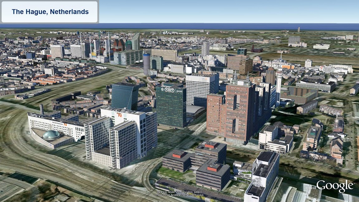
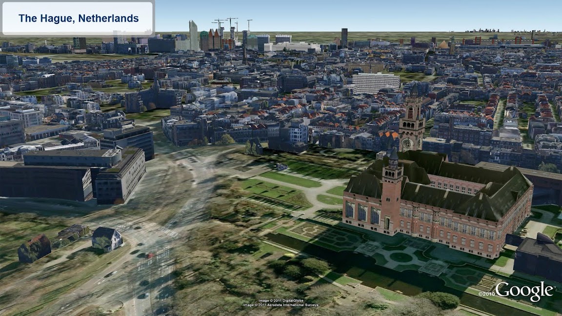
Looking for new 3D cities to explore in far off places? Well, you’re in luck! We’ve been hard at work expanding our 3D coverage by adding ten of thousands of 3D buildings to these cities:
  • Berkeley, California USA
  • Cologne, Germany
  • The Hague, Netherlands
See the new buildings for yourself with the “3D Buildings” layer in Google Earth or by using Google Maps with Earth view.


Happy touring!

Wednesday, June 29, 2011

Google Earth API and StrataLogica: Changing Education

Cross-posted on the Google Enterprise Blog

Editors note:
The Google team encounters fun and new ways of using the Google Earth and Maps API. Here’s an example of how a century old educational map and globe publishing company realized more students wanted to learn online and transformed their teaching methods to include a program built on the Google Earth API. Don Rescigno, from Herff Jones | Nystrom, explains how students and teachers benefit from technology in the classroom with StrataLogica.


With today's technology enabling information to travel at a much more rapid rate than in the past, students feel more advanced than what many of us can remember from our own days in school. Elementary school students use a school computer, manage multiple usernames and passwords, work with spreadsheets, develop their own blogs and websites, and more. They’re tech savvy and they’re connected.

The challenge for educators is to use tools and resources that take advantage of students' advanced technological skills. Combining educational content with technology like the Google Earth API gave us the opportunity to foster a new and immersive experience that changes the way students see our world.

StrataLogica—combined with the Google Earth API —provides students with powerful tools to visualize and comprehend the ways in which geography has impacted events, politics and populations throughout human history. Students have the ability to see current events, taking place around the world, from their classroom.

Using a computer or interactive whiteboard, students uncover layers of educational content and can then drill down to Google Earth’s satellite imagery, see what’s actually there, and even use historical imagery to compare then and now. Recently, I had to play the role of a teacher when one of my children overheard a CNN report on Japan and asked, “Dad, what made the earthquake and tsunami?” The ability to access and interact with so many resources—aerial imagery of the earthquake, videos, and photos posted by Japanese citizens, local news stories—allowed me to teach him about the Earth’s processes and their impact. It helped to create a better understanding beyond the news story. It fostered critical thinking and a global perspective.


Like so many with children, I want to see students learning in a new way that
inspires them. It’s important for our future generation to understand how we are all connected — to think globally and comprehend world impact. We want them to truly become global
citizens. StrataLogica and the Google Earth API are helping change the way students see the world; they can “fly” to any location in a matter of seconds, zoom in to imagery and see street views of historical sites that they may never have an opportunity to visit, embed videos and photos, and experience their own virtual field trips.

If you’re an educator interested in teaching geography, history, earth science and
more, visit stratalogica.com to learn more.

Monday, June 27, 2011

City names in Google Earth, now in your preferred language


We love to give you options on how to view information in Google Earth, but we also want to make sure we're organizing that information in a way that is useful and easy to read. We realize that a city may be referenced in different ways, in different languages. Presenting all of these names on the map in a single view can sometimes make the map harder to read, not to mention, may even detract users from other, useful information. In the interest of providing the smoothest browsing experience possible, we’ve updated Google Earth so that each city has just one label in a user’s default language.

These settings are flexible. If you would like to change the way in which cities are displayed, just follow these instructions to change your default language. If you prefer to see cities in two languages, turn on the ‘Local Place Names’ layer under the ‘More’ folder. This way, if you fly to the capital of Japan, for example, you’ll see both “Tokyo” and “東京“.

Click on “Local Place Names” to turn on a second, local name for each city.

And remember, if you think that there’s a better name for a city in your language, we’d love to hear your feedback via the "Report a Problem" link in the help center.

We hope this makes it even easier and quicker to find information. Keep exploring!

Wednesday, June 15, 2011

Watch the lunar eclipse from anywhere

(Cross-posted on the Official Google Blog)

We’re always fascinated by the unique wonders of space and the world—what can we say, it’s the geek in us! Naturally, when we learned that part of the world will be treated to a rare 100-minute long total lunar eclipse starting at 11:20am PDT today, we were both excited and disappointed that this rare occasion wouldn’t be visible from our Mountain View campus like last year’s eclipse. We suspect we aren’t alone, so you’ll be glad to know that we’ve worked with Slooh Space Camera to let you experience the spectacle wherever you are in the world, in real time.

Slooh will host a live mission interface using Google App Engine that lets anyone not lucky enough to live in certain areas (South America, Europe, Africa, Asia and Australia) take part in this rare astronomical event. It’s equipped with audio narrations from real-life astronomers so you can hear a firsthand, expert account of the event. You can also watch the live stream on the Google YouTube Channel or from the Sky layer in Google Earth (download this kml), while exploring the fascinating world that exists in our galaxy. Finally, those of you on the go can download the Slooh Space Camera Android app to view the images right on your phone.


If you're fortunate enough to be able to view this event in the sky, we hope you'll get the chance to step outside and indulge in the spectacle. For everyone else, we hope our moon madness helps brighten your day.

Update 11:37 PDT: Starting now, if you visit the Google homepage you’ll see a special interactive doodle, which will update throughout the day to show the latest state of the moon. Lunar imagery provided by Slooh.

Friday, June 10, 2011

3D trees in Google Earth - now in more cities around the world


Last month, we celebrated the trees of the great American wilderness on Arbor Day. Unfortunately, many of us don’t get the opportunity to visit majestic forests like these very often, which is why we're making them available on Google Earth.

Since we first launched 3D trees in Google Earth 6 last November, we’ve worked to bring this experience to more cities. Today, we are happy to announce that the latest group of cities with 3D trees include: New York, Philadelphia, Boston, London and multiple cities in the California Bay Area.


This new 3D imagery brings new perspective to your favorite historical buildings and parks. In Philadelphia we have complemented the Independence Hall model with new 3D trees in Independence National Historic Park to enhance the realism of the historic site. Other examples are Delacorte Theater in New York City and the the famous Emerald Necklace, a gem of Boston designed by Frederick Law Olmsted, a shared experience and memory for many people – locals and visitors alike.

Independence Hall in Philadelphia, Pennsylvania


Delacorte Theater in New York City, New York


Boston Common in Boston, Massachusetts

We hope that among these new cities you find fond memories of a park, a tree lined street, or even a special tree where you’ve had a fun picnic or family outing. To relive those memories by viewing 3D Trees (or start planning to make new ones), make sure you check the “Trees” layer under “3D Buildings” in your Google Earth left panel. Enjoy the new tree-lined city streets and filled-in parks!

Friday, June 3, 2011

Our Runners vs. Cyclists Flagstaff Challenge, in 3D


Most office rivalries rise to a boil at conference tables and water coolers. At Google’s Boulder office, our grudge matches play out across topo lines. Last week, our third annual “Flagstaff Challenge” blasted off up Flagstaff Road, Boulder, Colorado’s signature hill-climb. Over 1,500 feet of elevation gain, the Flagstaff Challenge (mapped below) attempts to answer our office’s ultimate water cooler question – what’s really faster: two wheels or two feet?
Bloggers in the office fired up Google’s KML Embed Gadget to cook up an embedded Google Earth course map (if the map below is not in 3D, try installing the Google Earth plug-in, then start embedding KML’s on your own site!).


As our route map shows, Flagstaff’s paved switchbacks criss-cross its running trail all the way up to the finish point, making this slice of topography perfect for an office grudge match between cyclists and runners.

While there was a good bit of trash-talking over GMail and in the halls leading up to the Challenge, Googlers generally prefer to let data speak for itself. Minutes after our team returned to the office, folks were already using Google Earth’s GPS tools to visualize tracks and dissect elevation profiles recorded on their My Tracks app or fitness units.

And yes, a few folks from the Docs team even fired up spreadsheets to run statistical analyses on the finish times. After accounting for outliers (those un-named Geo folks who actually got lost!), it turns out that there was no statistically significant difference between the cyclists and the runners. That just means our office feud will have to simmer for another year; enough time to sharpen our fitness and also the Geo tools we use to share and analyze our weekday warrior exploits!


Wednesday, May 25, 2011

Congratulations to Tine Valencic, the 2011 National Geographic Bee Champion

After preparing for months and working their way through a field of several million participating students, the top 10 geographic student masters, met in Washington D.C. today at National Geographic headquarters to compete in the National Geographic Bee. After 124 questions (including the championship round), Tine Valencic from Texas answered this one correctly to take the championship crown:

Question: Thousands of mountain climbers and trekkers rely on Sherpas to aid their ascent of Mount Everest. The southern part of Mount Everest is located in which Nepalese national park?
Answer: Sagarmatha National Park

Google is proud to support National Geographic Bee, for the 3rd year in a row. National Geographic and Google share the same passion for inspiring and encouraging our future generation of leaders and innovators to learn about and explore the world around them. Being geographically literate and understanding the world is a vital skill for students of all ages. Technology, like Google Earth, has helped make the world a more accessible place and students need geographic skills to be prepared for a global future.


Students who participate in the National Geographic Bee finals are fourth through eighth-graders from every state, the District of Columbia, Atlantic Territories, Pacific Territories, and Department of Defense Dependents Schools. They won their school Bees that were held in thousands of schools across the US. These school winners then took a written qualifying test, which was scored by the National Geographic Society in Washington, D.C. From the school winners, the top scorers in each state are eligible to participate in the State Bees. You can learn more about the students who won their State Bees using the interactive Google Maps gadget on the National Geographic YouTube Channel at http://www.youtube.com/nationalgeographic.

The first-place winner, Tine Valencic, won a $25,000 college scholarship, a lifetime membership in the National Geographic Society, and a trip to the Galápagos Islands. The second-place winner and recipient of a $15,000 college scholarship was Georgia's Nilai Sarda and third place and a $10,000 college scholarship went to Kansas' Stefan Petrović. The seven other finalists, who won $500, were Andrew Hull, of Alaska: Luke Hellum, of Arizona; Tuvya Bergson-Michelson, of California; Kevin Mi, of Indiana; Karthik Karnik, of Massachusetts; Alex Kimn, of South Dakota; and Anthony Cheng, of Utah.


The top 10 national finalists from both 2011 and 2010 are eligible to be selected for the three-person U.S. team at the National Geographic World Championship to be held at various locales in the San Francisco area in July 2011, with the finals taking place at Google headquarters in Mountain View.

Congratulations to Tine Valencic and to all of the students who participated in this year’s National Geographic Bee. We look forward to following all of you as you continue to explore the world and we expect to see some of you at Google after you have earned your degrees.