Thursday, June 23, 2011

Mapping in the Midwest


During one of the Map Maker Community team’s recent college campus events in Chicago, we had the pleasure of meeting Phil Swanson, an international studies and business student, who travelled nearly 200 miles to join our mapping event at the University of Chicago.

As soon as we started talking with Phil, his passion for mapping and computers came shining through, so we were excited to learn more about what drives him to add to, edit, and create using Google Map Maker.


According to Phil, it all started with retrofitting an interactive campus map when he was a web developer at the University of Wisconsin, Platteville. There was an existing version that utilized the Google Maps API, which he further developed, resulting in this useful campus map. Phil says about the project, “I love to make simple things for people to use, and I've always been interested in maps, so that project definitely created an interest in maps and mapping in general.”

Once Phil realized the positive impact his mapping could have on the university, he continued using Google Map Maker to ensure all of the campus details were correct. He began seeing his edits appear not only in Google Maps, but also on Google Maps for mobile on his phone when he searched maps near the university. “Seeing edits transition from Map Maker to Google Maps on mobile and filling in the details make maps that much more useful for me and the world,” Phil said about mapping his town and the campus.


What aspect of the maps does Phil enjoy most? "I love mapping buildings. Seeing the buildings from my University show up on my phone is the best.” Phil has developed a handy system of finding what needs to be fixed on the map, going out with his phone to take pictures, then adding those photos to a web album which he can then include with his edits in Map Maker. “This is especially useful for buildings . . . . It might sound obvious, but I find that my edits are much more likely to get approved if I describe what I'm doing and link to a photo for a more complex edit.” What a helpful technique to use during the review process!

We want to thank Phil for taking the time to hang out with us in Chicago, and also for sharing with us what excites him about mapping. We look forward to seeing more great mapping from Phil, and hope other students are inspired to make the maps of their own colleges and universities more comprehensive and detailed!

For more useful tips like Phil’s, visit the Map Your World Community forum to see what others are doing.

Thursday, June 16, 2011

More Building Maker cities and a new competition, too

[Cross-posted from the SketchUp Blog]

It’s a great day for the citizens of Argentina -- and for Canadians in the nation’s capital. We’ve released new Building Maker imagery in six new cities:

  • Buenos Aires, Argentina
  • Córdoba, Argentina
  • Mar Del Plata, Argentina
  • Mendoza, Argentina
  • Rosario, Argentina
  • Ottawa, Canada

...but that’s not all! To help these cities get modeled, we’re having the first ever modeling competition for Building Maker. Starting today, you can create models in these six cities to win prizes in two different categories: Best Model and Most Models. The first place prize is a GPS-enabled digital camera; second place is a Building Maker shirt; and third is a Google travel mug. Have fun!


Wednesday, June 15, 2011

Watch the lunar eclipse from anywhere

(Cross-posted on the Official Google Blog)

We’re always fascinated by the unique wonders of space and the world—what can we say, it’s the geek in us! Naturally, when we learned that part of the world will be treated to a rare 100-minute long total lunar eclipse starting at 11:20am PDT today, we were both excited and disappointed that this rare occasion wouldn’t be visible from our Mountain View campus like last year’s eclipse. We suspect we aren’t alone, so you’ll be glad to know that we’ve worked with Slooh Space Camera to let you experience the spectacle wherever you are in the world, in real time.

Slooh will host a live mission interface using Google App Engine that lets anyone not lucky enough to live in certain areas (South America, Europe, Africa, Asia and Australia) take part in this rare astronomical event. It’s equipped with audio narrations from real-life astronomers so you can hear a firsthand, expert account of the event. You can also watch the live stream on the Google YouTube Channel or from the Sky layer in Google Earth (download this kml), while exploring the fascinating world that exists in our galaxy. Finally, those of you on the go can download the Slooh Space Camera Android app to view the images right on your phone.


If you're fortunate enough to be able to view this event in the sky, we hope you'll get the chance to step outside and indulge in the spectacle. For everyone else, we hope our moon madness helps brighten your day.

Update 11:37 PDT: Starting now, if you visit the Google homepage you’ll see a special interactive doodle, which will update throughout the day to show the latest state of the moon. Lunar imagery provided by Slooh.

My Places now helps you manage your important locations


Almost every day you encounter new places and businesses, whether it’s a new store you spotted on your commute to work, or a restaurant you visited with friends over the weekend. To date, you’ve been able to star places on Google Maps, rate them via Google Places, or add them to a customized map with your own icons and annotations through My Maps.

But keeping track of all the locations you care about and memorizing which places you starred or rated isn’t easy. So today, we’re unveiling the new My Places tab on Google Maps, which helps you quickly view and interact with your saved maps, starred locations, and rated businesses.


The My Places tab replaces the My Maps tab in the Google Maps toolbar. Items are organized by date with your most recent activity at the top, and filters make it easy to sort and view only your maps, starred locations or rated places. And of course, you can still create and share personalized My Maps through the “Create new map” link.

My Places also simplifies your ability to manage the locations that make up your personalized maps experience. Using the drop-down arrow next to each location in your list, you can easily delete any of your saved maps, stars or Google Places ratings. These personalization changes will automatically be synchronized across all other Google properties including Google Places, Google Maps, and Google Maps for mobile.

To use My Places, you’ll need to sign in with your Google account. Try it now: visit Google Maps and click the My Places tab to access and organize the places you care about.

Monday, June 13, 2011

Introducing Descriptive Terms in Local Search Results


(Cross-posted on the Google Places and Small Business blogs.)

Whether it’s to find a great place for dinner or to grab a cup of coffee, I often look up places directly on Google Maps. Evaluating my options and making a choice just got even easier thanks to the list of associated terms that now appears directly in the local search results.

Starting today, Google Maps search results in the U.S. and Great Britain will include some of the phrases which are most frequently used to describe those places. These phrases come from sources all across the web, such as reviews, web pages and other online references, and they can help people quickly identify the characteristics that make a particular place unique. It’s like an opportunity to ask the business owner or its patrons “What’s good here?” or “What do most people get here?”

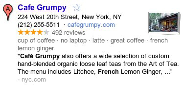
For example, if I’m looking for a place to relax and enjoy a great cup of coffee this weekend, I can see at a quick glance that Cafe Grumpy could be the perfect spot. Besides being known for their “latte” and “great coffee,” they have a “no laptop” policy — exactly what I was hoping for since I’d like to unplug and take a break from work this weekend.


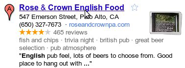
Or if I’m planning to visit friends on the west coast and need to organize a night out, Rose & Crown could be an excellent choice given their “great beer selection” and “trivia night” games on site!


Whether you’re looking for local businesses in your neighborhood or in another city, these descriptive terms can help you find the places right for you. We hope you use these terms to discover new and interesting places on Google Maps, and watch for this feature to appear in Place search on Google.com and Google Maps for mobile soon!

Posted by Manjunath Srinivasaiah, Software Engineer

Friday, June 10, 2011

3D trees in Google Earth - now in more cities around the world


Last month, we celebrated the trees of the great American wilderness on Arbor Day. Unfortunately, many of us don’t get the opportunity to visit majestic forests like these very often, which is why we're making them available on Google Earth.

Since we first launched 3D trees in Google Earth 6 last November, we’ve worked to bring this experience to more cities. Today, we are happy to announce that the latest group of cities with 3D trees include: New York, Philadelphia, Boston, London and multiple cities in the California Bay Area.


This new 3D imagery brings new perspective to your favorite historical buildings and parks. In Philadelphia we have complemented the Independence Hall model with new 3D trees in Independence National Historic Park to enhance the realism of the historic site. Other examples are Delacorte Theater in New York City and the the famous Emerald Necklace, a gem of Boston designed by Frederick Law Olmsted, a shared experience and memory for many people – locals and visitors alike.

Independence Hall in Philadelphia, Pennsylvania


Delacorte Theater in New York City, New York


Boston Common in Boston, Massachusetts

We hope that among these new cities you find fond memories of a park, a tree lined street, or even a special tree where you’ve had a fun picnic or family outing. To relive those memories by viewing 3D Trees (or start planning to make new ones), make sure you check the “Trees” layer under “3D Buildings” in your Google Earth left panel. Enjoy the new tree-lined city streets and filled-in parks!

Thursday, June 9, 2011

A tour of the U.S. Green Building Council's headquarters

[Cross-posted from the SketchUp blog]

You could call our friends at Igloo Studios “multi-taskers”. While they mainly concentrate on creating products and plugins for designers and architects, they also have a podcast, a SketchUp training program and a popular book.

Their latest project is a virtual tour of the U.S. Green Building Council’s headquarters in Washington, D.C. (Note: you’ll need the Google Earth plugin installed to view).


This project is cool for lots of reasons. For starters, USGBC’s 75,000-square-foot facility is loaded with efficient and innovative green features that have earned the building a LEED Platinum rating. Professionals regularly tour the USGBC for real-world examples of successful green practices.

USGBC headquarters

However, not everyone has the luxury of being able to visit Washington DC, so Igloo Studios built this one-of-a-kind Google Earth tour of the building. Using a custom instance of the Google Earth plugin and building product catalogs from the 3D Warehouse, Igloo was able to create a tour of both the exterior and interior of the building!

The tour features interactive elements

As you navigate through the 3D building, you’ll notice it’s jam-packed with other goodies like a guided audio tour, photos and embedded videos. You can even click on the building’s materials and products to learn more about the green tech used in its construction.

Once you finish the tour, you can launch a test that will earn you the same continuing education credits that you would get for taking the live tour.

And the coolest feature of all: if you find a building product during the tour that might be useful in one of your projects, you can download it directly into your SketchUp design!

Learn about building materials and then bring them into your model

If you're interested in learning more about how your products or buildings can be visualized in this way, be sure to send Igloo an email.

Posted by Chris Cronin, SketchUp Pro Sales